The Roscosmos State Corporation spoke about the successes of the "Digital Earth" project, which Terra Tech (part of the RKS holding of Roscosmos) has been working on for five years. The results of the second phase of scaling "Digital Earth" to the entire territory of Russia were successful. It is noted that the platform "has established itself as the best practice in the field of Earth remote sensing in Russia according to the criteria of scale, automation, and the use of AI technologies".
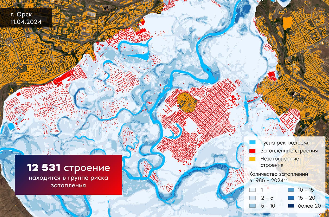
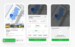
The "Digital Earth – Services" project is being implemented by the geotechnology operator AO Terra Tech by order of the Roscosmos State Corporation as part of the national program "Digital Economy of the Russian Federation." It is a tool for obtaining objective information about natural assets and economic activities using satellite images. Among other things, the system helps to assess damage from fires, floods, and even can be connected to the investigation of crimes.
Working with Earth remote sensing data and products in the Digital Earth complex of ge сервисов is carried out through individual or collective access through a geoinformation web portal. Data processing is automated using neural networks, statistical analysis, and expert data control.
The project meets the new five-year period with a significant expansion of the range of services offered, as well as opening access to geo сервисов to businesses and citizens.
In digital terms, the Digital Earth complex of geo сервисов has received in five years:
- 500 million km² of processed satellite images;
- 70 million km² or fourfold coverage of the entire territory of Russia;
- 5000 completed orders;
- 2000 registered users;
- 1000 own datasets with a set of Earth remote sensing for use in machine learning algorithms;
- 100 developed neural networks;
- 27 information products generating ready-made geoanalytics;
- 7 industry service areas;
- 3 modes of creating information products for the formation of overview data.
Earlier in June, the Roscosmos State Corporation announced that it is accepting orders for satellite imagery from ordinary Russians.
Read materials on the topic:
Floods, fires, objects from 70 cm – what and how the Russian "Resource-P" sees from space
Little VERA: Russia is starting mass production of plasma engines for nanosatellites