The 2GIS team has launched a new service called "2GIS Linza," which is a complex of a mobile application and software that uses artificial intelligence to shoot photo and video surveys of territories.
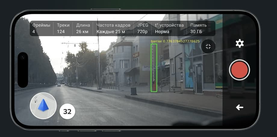
The system automatically recognizes objects and helps create archives of the state of territories, which is convenient for further analysis on the city map using the "2GIS Pro" geoanalytics service.
"2GIS Linza" simplifies urban and business tasks related to the development of territories, collecting data for future "smart" cities. The service automatically recognizes infrastructure elements, saves photos with coordinates, which allows you to quickly put them on the map, avoiding the lengthy and expensive process of deciphering video.
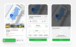
The "2GIS Pro" service is used for visualization and further data analysis, which allows you to combine digitized materials with other data, such as the location of organizations, heat maps of demand for goods and services, and population density.
Read materials on the topic:
Highly detailed roads for cars with Apple CarPlay and Android Auto have appeared in 2GIS
2GIS service launched route projection onto the windshield of a car
2GIS has added support for quick commands with AI functions for iPhone users
Now on home

Start of deliveries scheduled for 2027

Over 51,000 new motorcycles were sold in Russia in 2025

The car will take at least a year to assemble

The application's audience has reached 20 million users

The model will be included in the list of cars for taxis, price - from 2.25 million rubles
All parking lots of the "Administrator of the Moscow Parking Space" are connected to the service

The cars will be supplied to the Moscow Transport Service Directorate

Deliveries to India may begin in 2028

The technology provides automated search for all types of defects in power units

The plane flew 500 km, accelerating to 425 km/h

The plant stated that the information about the termination of purchases for models 6 and 8 is not true
Scientists are using the "Ekran-M" installation