Innopolis University has developed a platform for creating digital twins of cities. This is a system that can be customized for any city and used to automate the management of residential and commercial real estate, transportation, lighting and landscaping, as well as model the load on urban infrastructure.

Why a city might need a digital twin
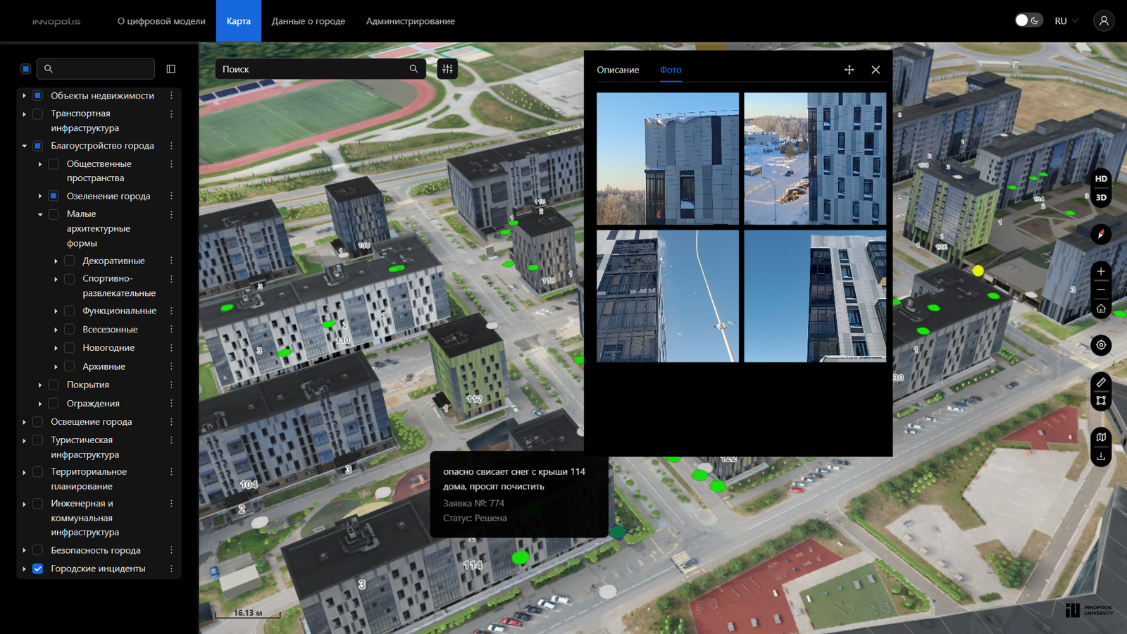
A digital city management platform is a virtual ecosystem for managing the real urban environment. The product combines 3D visualization, database management, documentation, analytics, and resident requests.
According to the developers, the solution has already been applied in the creation of a digital twin of Innopolis. It is expected to be useful for city halls, developers, investors, and construction companies.
The tool can help the administration maintain the current infrastructure, quickly track and eliminate urban incidents, as well as make tactical and strategic decisions on the development of public spaces, residential buildings, transport hubs, and other systems, said Ksenia Krasnova, Head of Projects at the Center for Geospatial Solutions at Innopolis University.
The world's first such project was launched in Singapore in 2014. It is still being improved: data is updated, new technologies and calculation models are added.
How it works in practice
The Innopolis University platform is designed to be customizable for any city, regardless of its size. The developers integrate data from various urban systems into the digital twin — cadastre, housing and communal services, engineering system sensors, environmental monitoring, and other sources.
If necessary, municipality employees can manually add additional services and data.
The platform can be connected to external services that the mayor's office already uses: video surveillance, weather reports, air quality sensors, data on the fullness of garbage cans. All this data is updated in real time.
What will change for residents and officials
One of the important modules of the platform is the incident management block. With its help, a city hall employee will be able to quickly track residents' requests: for example, for repairing a section of road, replacing street lamps, and other incidents.
Moreover, the system will automatically distribute applications and appoint contractors responsible for correcting the situation. Officials will only have to monitor the status of execution.
Ksenia Krasnova notes that for administration employees, the use of the platform will speed up the search for urban data by 90% and increase the quality of information about real estate, socio-economic indicators, and the state of urban infrastructure by 80%. According to her, the solution will also reduce the manual workload on specialists by 1.5 times and make control over the execution of citizens' appeals 100% transparent.
What is special about the development
When creating the platform, experts from the Center for Geospatial Solutions of the IT university used their own products: software for 3D visualization of urban information and a BI constructor for working with big data, managing charts, and generating analytical reports.
The solution has global analogues, but its advantage in the Russian market is the use of import-independent 3D visualization of the urban environment.


Комментарии