MIPT has developed the MSSPlace system, which helps robots recognize locations and determine their position even in bad weather, low light, and satellite navigation problems. The system combines data from cameras, lidars, semantic masks, and textual scene descriptions. As an output, it creates a digital description of the place — a descriptor.
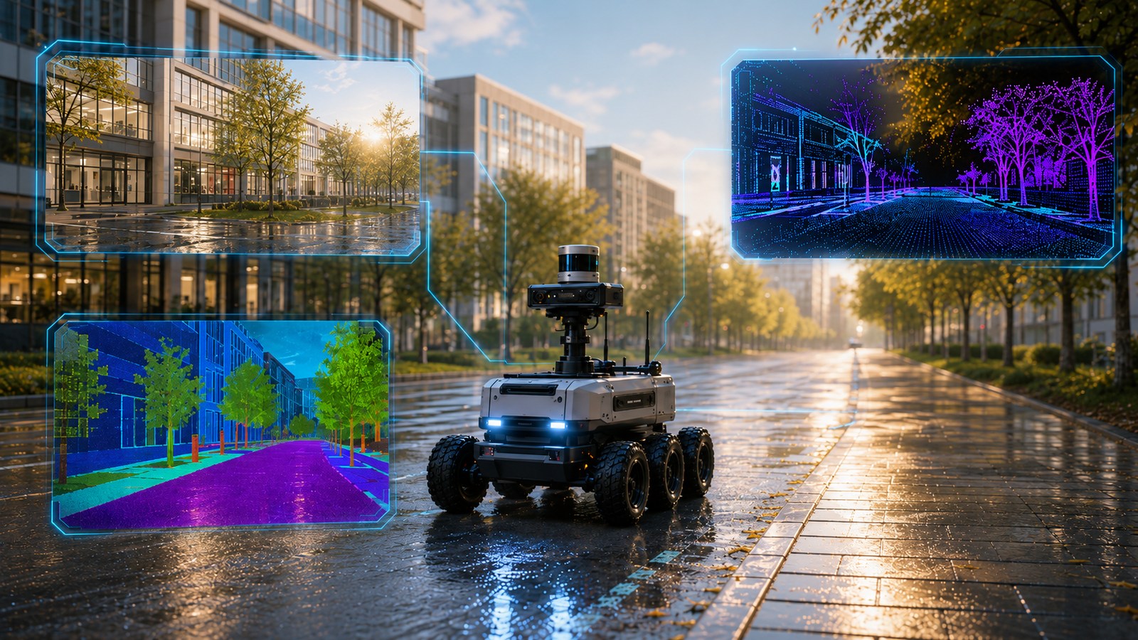
As the robot moves, it collects a database of such descriptors for visited locations. If it needs to understand where it is now, the system compares the current descriptor with the database and searches for the most similar place.
The main idea is that the robot does not rely solely on a camera or solely on a lidar. A camera poorly shows distances, a lidar builds a 3D map without a full understanding of objects, but together these sources provide a more stable picture.
Semantic simplified images play a special role, where objects are labeled by meaning: road, tree, building, and other elements. They are less dependent on the time of day, season, and lighting.
The development can be useful for autonomous vehicles, delivery robots, cleaning robots, and adaptive drones. MIPT also included the results in the open-source software library OpenPlaceRecognition.


Комментарии