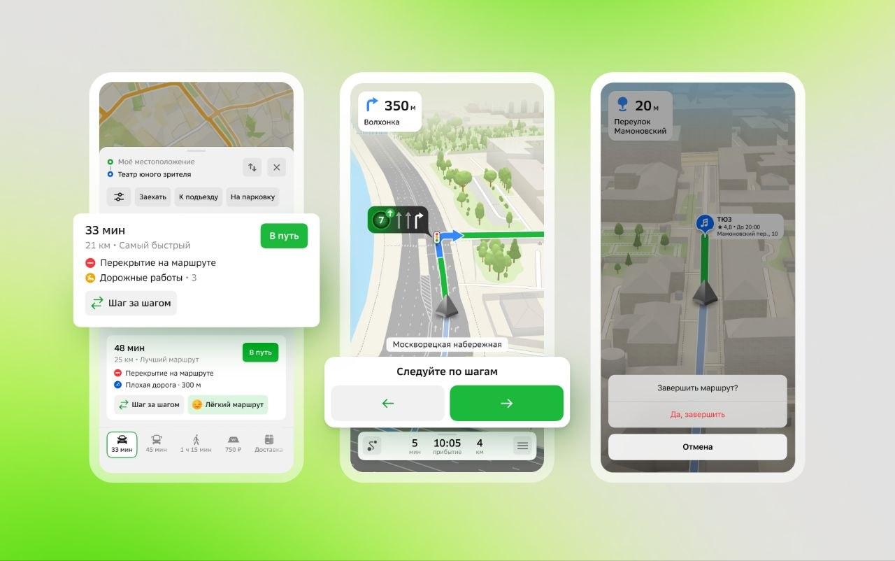
2GIS has added a "Step by Step" mode that helps you navigate even when GPS and GLONASS fail. Now the navigator doesn't "get lost" along with the signal, but rebuilds its work to a simpler and more understandable logic.

If geolocation starts to behave erratically, the app itself offers to switch to the new mode. Instead of the usual blue dot, the user receives a step-by-step route: where to go, how far to the next turn, and what to focus on along the way.
The function works in all scenarios at once — in car, truck, and pedestrian navigation.
In addition, it is now possible to manually set your location. Just click "Specify where you are" — and the application will fix the point, after which the map will continue to work without reference to satellites.
The developers emphasize that the problem is not with the application itself, but with the data source. Geolocation is determined by the device via satellites, and then transmitted to the navigator. If the signal is unstable, all services suffer.
The new mode is just needed for such situations — so that the route remains clear, and the movement does not turn into a guessing game.


Комментарии