The Russian company "Geoscan" has for the first time presented its new development — the "CubeSat 16U" satellite platform. This was reported by the company's press service.
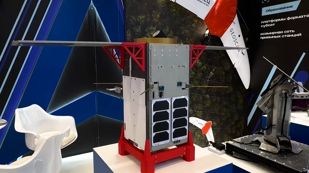
This compact but powerful device will be able to operate in orbit for up to five years, taking pictures of the Earth's surface. One of the key advantages of the new satellite is the stabilization system, which is considered one of the most accurate in Russia. The first device is planned to be launched into near-Earth orbit in the coming months.
The "CubeSat 16U" satellite in its folded state has dimensions of 25.13 x 25.13 x 45.4 cm. It provides power supply, control, orientation and stabilization, and also supports two-way communication with a ground station. The device is designed to operate in low Earth orbit at an altitude of 400 to 600 km, with a maximum weight of 30 kg.
The orientation and stabilization system includes a star sensor, a three-axis fiber optic gyroscope, a GNSS receiver, magnetometers and solar sensors. This technical solution allows the CubeSat to maintain a stable position in space. This is critical for remote sensing of the Earth, as even the slightest vibrations can reduce the quality of images.
The control algorithms provide an orientation accuracy of 0.006 °/s and automatic position correction. A 230 W*h battery provides energy to all systems, and a high-speed X-band transmitter with a bandwidth of up to 250 Mbit/s allows you to quickly send the collected data to Earth.
The first satellite built on the basis of this platform will be "InnoSat16", which is scheduled to be launched in the summer. It will be equipped with a panchromatic camera with a resolution of 2.5 meters per pixel. In the autumn, "Lobachevsky" will be sent into orbit — a CubeSat of the Nizhny Novgorod State University, which will receive multi- and hyperspectral cameras for agroecological research.
Earlier www1.ru reported that Geoscan presented "Pioneer Mini 2" — the first Russian educational drone with on-board AI for schools and universities.
Read materials on the topic:
"Geoscan" provides 40% of the state civil order for drones
The Moon and Mars will have domestic 3D doubles: Geoscan's CubeSat satellites will be used
Комментарии