2GIS has introduced a unique innovation in Moscow: the navigator now displays real-time traffic light signals. This is the first project of its kind in Russia, and it can already be tested in several districts of the capital, including Tsvetnoy Boulevard, Krylatskoye, Veyernaya Street, and others.
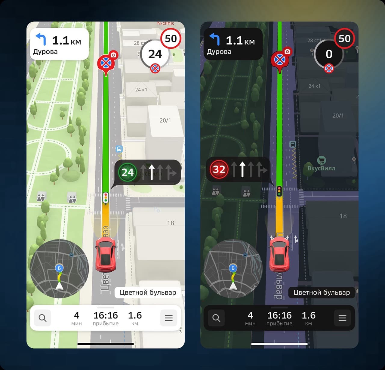
The feature is available in the latest version of 2GIS for iOS and Android, as well as on multimedia screens in cars that support Apple CarPlay and Android Auto. On the navigator screen, users see not only the current signal of the nearest traffic light but also a timer with a countdown to its change.
The system is synchronized with intelligent traffic lights equipped with timers. It shows only the signals that are relevant to the driver's current route. This avoids confusion at intersections and makes driving safer. For example, the navigator will only show a green light if it is green in the direction of the route, even if a different signal is active in other directions at that moment.
Data on the operation of traffic lights is provided by the Moscow Center for Traffic Management (TsODD) using an automated traffic management system (ASUDD).
Deputy Mayor of Moscow for Transport, Maxim Liksutov, noted that this pilot project is the first of its kind in the country. It will help drivers navigate the road in advance, reduce speed if the green light is ending, and generally increase the safety and predictability of traffic.
Read more on this topic:
2GIS Introduces 3D Models of Public Transport in Russia: They Move on the Map
2GIS Launches Route Projection onto Car Windshields
2GIS Spring Update: New Features for Convenient Navigation
Комментарии